Project Overview
Like most communities across the country, the Richmond region has experienced near-record roadway deaths and injuries in the past few years.
While these types of crashes are starting to trend down, we are a long way off from significantly reducing roadway violence on our streets. This is especially true if a community's goal is zero deaths (or towards zero deaths), commonly referred to as "Vision Zero".
Preventable Crash Outcomes (2026)
Road deaths and serious injuries carry an enormous cost, not just in human terms, but in measurable economic and societal impact. The 39 people killed and 316 seriously injured on Richmond region roads so far in 2026 represent an estimated $968 million in comprehensive costs to our region, using Virginia-specific figures from VDOT. This number does not take into account crashes that result in moderate injuries or property damage.
A major change in how we approach and think about safety is needed if we hope to make a lasting impact on our transportation network.
This regional safety plan update will move beyond identifying safety concerns and establish a clear framework of next steps, policy directions, and actionable strategies.
It will build on lessons from our member communities and prior regional initiatives to better define regional safety priorities and establish a transparent and community-driven process for safety initiatives.
This study is the update to the Richmond Regional Transportation Safety Plan and complements existing efforts such as the Virginia Strategic Highway Safety Plan and the VDOT Pedestrian and Bicycle Safety Action Plan.
Take a moment to watch the video to learn more about an important tool we're using to better plan for safety focused infrastructure investments: Identifying Safety Corridors. Your input will help us develop profiles of these stretches of roads across the region.
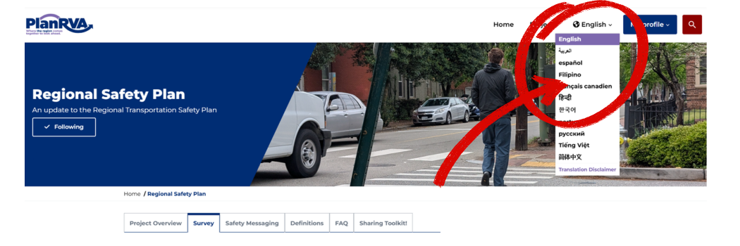
How to Translate this Page
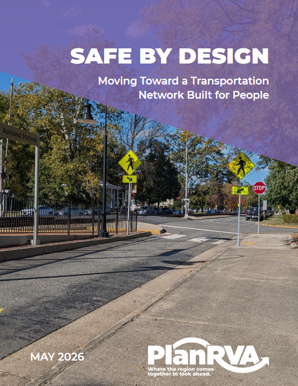
Draft Plan
Safe by Design: Moving Toward a Transportation Network Built for People is now drafted and ready for review.
The plan reflects more than a year of technical analysis, community conversations, and regional collaboration. Between February and March 2026, more than 2,000 residents, workers, students, and travelers contributed input through a public safety perception survey, direct conversations at more than 30 community events, and candid discussion in regional online forums. What they described—speeding, gaps in pedestrian infrastructure, dangerous intersections, and streets that feel designed for speed rather than people—shaped every section of the plan.
The plan is organized around a core conviction: serious crashes are not inevitable. They are the predictable result of how streets are designed, and they can be reduced by changing those designs. Drawing on crash data, a High Injury Network identifying where serious crashes are most concentrated, and the input of residents across the region, the plan establishes six specific actions the region will take together:
- Develop a Regional Street Design Manual that gives localities shared standards for designing streets that protect all road users
- Launch a Road Safety Assessment (RSA) Program to systematically evaluate high-risk locations using technical analysis and community knowledge
- Establish a Quick Build Library of low-cost, fast-to-implement safety improvements that localities can deploy without waiting years for capital projects
- Implement Quick Build Projects on the region's highest-injury corridors guided by RSAs, with priority given to communities that bear the greatest crash burden
- Advance Complementary Safety Plans, connecting this regional framework to on-the-ground action
- Track Progress and Keep Safety a Regional Priority through a public-facing dashboard, annual reporting, and integration with regional transportation programming
The plan is guided by the Safe System approach, which holds that human life and health are the highest priorities in transportation, that people will make mistakes, and that the system itself must be built to absorb those mistakes without killing or seriously injuring anyone.
The RRTPO Policy Board is scheduled to consider adoption of the plan this summer.
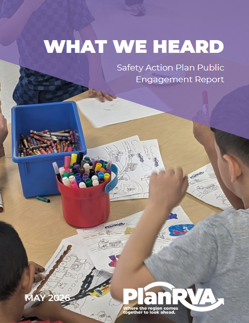
Engagement
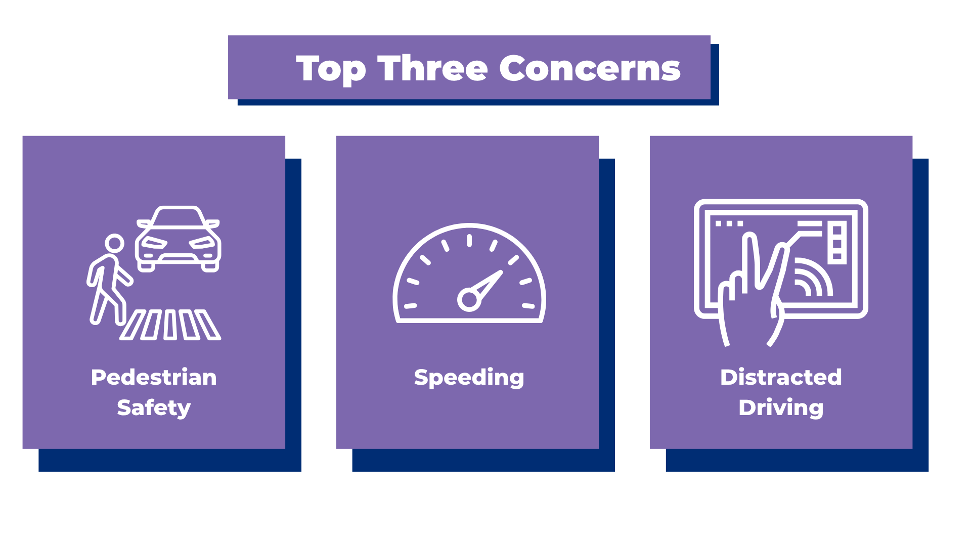
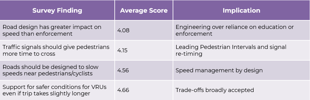
The survey data supports what the Safe Systems approach and Safe System Pyramid tells us: design the road, change the outcome:
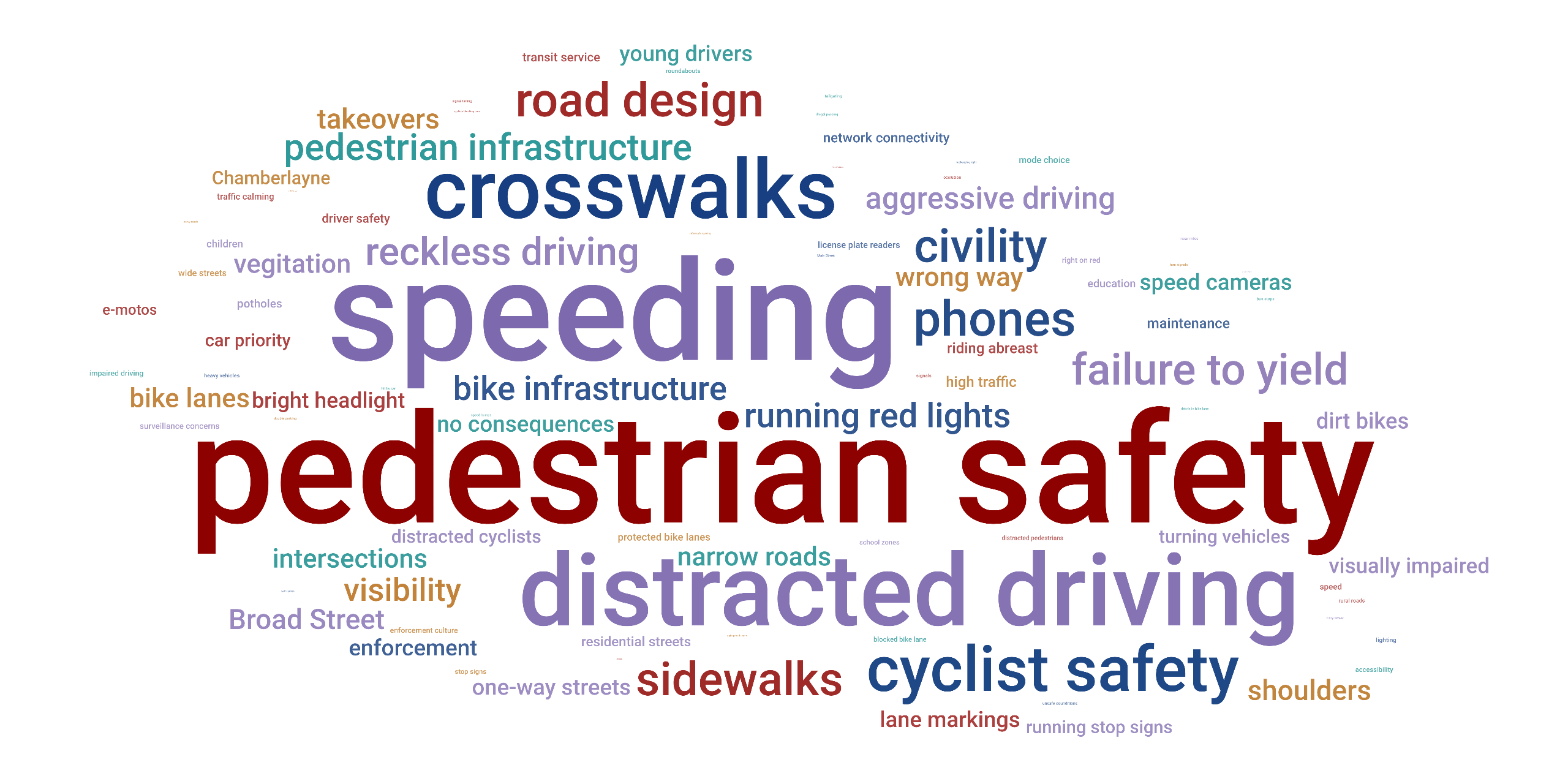
Word cloud of safety survey open ended comments. The larger the term, the more frequently it was mentioned.
Survey Notice
The public survey was open from February 10 - March 31, 2026 and is now closed.
Everyone deserves to feel safe getting where they need to go, whether walking, rolling, biking, driving, or riding transit. This survey is part of a regional effort to better understand how people experience travel in their communities and what changes could make our roads safer for all.
By sharing your thoughts, you’ll help local leaders and planners understand what safety means to you—what feels safe, what doesn’t, and what kinds of improvements you’d support.
Your feedback will shape future safety campaigns, transportation planning, and policies that aim to reduce harmful crashes and save lives across the region.
Safety Messaging
Definitions + FAQs
ADA Transition Plan: A document that identifies barriers to accessibility for people with disabilities in public rights-of-way and schedules corrective actions over time, including curb ramps, accessible pedestrian signals, and sidewalk conditions.
Complete Streets: A design approach that ensures roads are planned, designed, and operated to enable safe travel for all users regardless of age, ability, or mode—including people walking, rolling, cycling, driving, and using transit.
Countermeasure: A specific safety treatment or intervention designed to reduce the likelihood or severity of crashes at a particular location or on a particular corridor. Examples include high-visibility crosswalk markings, curb extensions, and leading pedestrian intervals.
Curb Extension: A widening of the sidewalk at an intersection that shortens the pedestrian crossing distance, improves sight lines between pedestrians and drivers, and slows turning vehicles. Also called a bulb-out.
Federal Highway Administration (FHWA): The U.S. Department of Transportation agency that administers federal highway programs and publishes design guidance referenced throughout this plan, including the Small Town and Rural Design Guide.
High Injury Network (HIN): A map of the road segments where fatal and serious injury crashes are most concentrated. Built from crash data weighted by severity, the HIN identifies where safety investment will have the greatest measurable impact.
Highway Safety Improvement Program (HSIP): A federal core program that provides funding to states for safety infrastructure improvements on public roads. Projects must be data-driven and aligned with state safety priorities.
Killed and Seriously Injured (KSI): A combined metric used in transportation safety analysis to measure the most severe crash outcomes. Using KSI rather than fatalities alone captures the full burden of life-altering harm on a network.
Leading Pedestrian Interval (LPI): A signal timing strategy that gives people walking or rolling a head start of several seconds before vehicles receive a green light, increasing pedestrian visibility and reducing conflicts with turning vehicles.
Long Range Transportation Plan (LRTP): A federally required planning document that identifies transportation goals, needs, and investments over a 20-plus year horizon for a metropolitan planning area. PlanRVA updates the regional LRTP on a four-year cycle, which also governs the plan review schedule described in the Implementation section.
Near-Miss: A situation in which a serious crash was narrowly avoided. Near-miss data, when systematically collected, can identify dangerous conditions before a fatal or serious injury crash occurs. This plan references near-miss reporting as an emerging data source for the regional safety strategy.
Pedestrian Refuge Island: A raised or marked median that allows pedestrians to cross one direction of traffic at a time, reducing exposure and providing a safe stopping point in the middle of wide roadways.
PlanRVA: The metropolitan planning organization (MPO) serving the Richmond, Virginia region. PlanRVA coordinates regional transportation planning, manages federal transportation funds, and convenes multi-jurisdictional planning processes across nine member localities.
Priority Safety Corridors: Extended roadway segments, typically several miles in length, drawn from and informed by the High Injury Network but organized around the functional geography of the regional road network.
Quick Build: Low-cost, rapidly deployable safety improvements (such as flexible delineators, high-visibility crosswalk markings, temporary curb extensions, and protected bike lane elements) that can be installed in weeks or months rather than years. Quick builds improve safety immediately and generate before/after data to support the case for permanent infrastructure investment.
Road Safety Assessment (RSA): A formal, evidence-based evaluation of an existing road or intersection conducted by a multidisciplinary team to identify crash risk and generate tiered recommendations. RSAs are recognized by FHWA as a proven safety countermeasure with documented crash reductions.
Richmond Regional Transportation Planning Organization (RRTPO): The formal governing body of PlanRVA, composed of elected officials and appointed representatives from member localities. The Policy Board sets regional transportation priorities and approves federally required planning documents.
Safe System Approach: A framework for transportation safety grounded in the premise that human error is inevitable and that the road system should be designed so that mistakes do not result in deaths or serious injuries. Responsibility for safety is shared among those who design, build, operate, and use the transportation system.
Strategic Highway Safety Plan (SHSP): A statewide, data-driven safety plan that identifies priorities and strategies for reducing highway fatalities and serious injuries. Virginia's SHSP establishes a goal of cutting fatalities and serious injuries in half by 2045, a target this plan aligns with.
SMART SCALE: Virginia's project prioritization and funding process for transportation improvements. Projects are scored on safety, accessibility, environmental quality, congestion reduction, economic development, and land use factors, and are funded through the state's Six-Year Improvement Program.
Safe Streets and Roads for All (SS4A): A federal grant program administered by the U.S. Department of Transportation that funds regional and local planning and implementation efforts to reduce traffic fatalities and serious injuries.
Technical Advisory Committee (TAC): A committee of local government staff, agency representatives, and technical experts that reviews and advises on transportation planning activities before they advance to the RRTPO Policy Board.
Transportation Improvement Program (TIP): A federally required short-range programming document that lists transportation projects in the region that are funded and scheduled for implementation. Projects must be included in the TIP to receive federal funding.
Traffic Records Electronic Data System (TREDS): The Virginia DMV's crash records database. All crash data cited in this plan is drawn from TREDS.
Unified Planning Work Program (UPWP): An annual document describing the transportation planning activities a metropolitan planning organization will carry out with federal planning funds. Inclusion of this plan's development in the FY2026 UPWP reflects the region's formal commitment to the work.
Virginia Department of Transportation (VDOT): The state agency responsible for building, maintaining, and operating the state highway system. VDOT owns and manages most roads in the Richmond region outside of the Richmond and Henrico.
Vision Zero: A commitment to eliminate all traffic fatalities and serious injuries. Vision Zero frames roadway deaths as preventable rather than inevitable and places primary responsibility on system designers rather than individual road users.
Vehicle Miles Traveled (VMT): A measure of the total distance driven by motor vehicles in a given area and time period. Land use policies that reduce VMT (such as mixed-use development near transit) can reduce overall crash exposure.
Vulnerable Road Users: People who face elevated risk of death or serious injury in a crash because they lack the physical protection of an enclosed vehicle. In this plan, the term refers primarily to pedestrians and cyclists, and also includes people using mobility devices such as wheelchairs and scooters.
The transportation system exists to move people and goods, but its foremost obligation is to preserve human life. Every other benefit—mobility, commerce, economic growth—depends on the assumption that the system does not impose unnecessary risk of death or serious injury on those who use it.
- In the Richmond region in 2024, 134 people were killed in roadway crashes, with 857 more receiving severe injuries.
- The economic cost of roadway crashes in our region is estimated at more than $5 billion per year, including medical care, lost productivity, property damage, and legal costs.
- Transportation agencies at all levels have an established duty of care to protect the public.
- The Commonwealth of Virginia and the federal government have embedded safety as a core principle through the Safe System approach.
- No other element of the transportation system carries such immediate and widespread risk to life as do roadway crashes. Transit delays may inconvenience, and economic inefficiencies may harm productivity, but roadway crashes cause sudden, irreversible loss of life and permanent injury.
- Unlike other priorities, roadway safety failures cannot be undone. A lost life cannot be recovered, which places safety in a unique and paramount category.
- Surveys consistently show the public ranks safety among their top transportation concerns. People expect that walking, biking, driving, and transit trips do not expose them or their families to unnecessary risk.
- Vulnerable road users and certain segments of the population (pedestrians, cyclists, transit riders, children, older adults, low-income residents) bear a disproportionate share of the risk.
The evidence establishes a clear message: safety must come first. It is the non-negotiable baseline for a functioning transportation system. Efficiency, mobility, and economic development all depend on safety being secured. Without it, the system exposes the public to unacceptable levels of harm.
Roadway safety is not just one goal among many, it is the single overriding priority.
Setting safety targets is an annual requirement tied to federal and state performance measures. Federal road funding is tied to performance, and in safety it is measured by the number of people killed and seriously injured on our roadways.
The state sets targets for all of Virginia and MPOs then decide to follow state targets or set their own.
For our 2026, PlanRVA set fatality targets that are lower than those set by VDOT for the Richmond region. Our 2026 targets are...
Fatalities: 107
Serious Injuries: 833
Non-Motorized Fatalities and Serious Injuries: 108
These targets are not goals we aspire to. They are based on five-year rolling averages, which is important because it means any single year, good or bad, has limited influence on the target numbers.
What does this all mean?
It means that safety targets based on five-year averages are limited in their usefulness for discussing current safety concerns because they intentionally smooth out recent changes. By design, 4/5ths of the value is driven by past conditions.
To many people it feels inherently wrong to talk about adopting a target of 107 deaths on our roadways, or hundreds of people seriously injured.
And it can seem contradictory or even disingenuous to advance these targets at the same time we’re talking about goals like vision zero or towards zero deaths.
These are five-year targets required by the federal and state governments and they do not prevent us from pursuing the goal of zero deaths on our roadways.
Vision Zero is a long-term commitment about where we are trying to go. It is not constrained by five-year averages or federal formulas. Vision Zero exists precisely because those target numbers are unacceptable, and it sets the direction for the policies, investments, and system changes needed to move beyond what the targets alone can show.
- Set clear regional safety priorities and identify the road corridors where the most serious crashes happen
- Involve the community in shaping priorities through surveys, meetings, and other input
- Build safety profiles for key corridors to better understand crash patterns and risks
- Recommend policies and funding strategies that support lasting safety improvements
- Create a flexible framework that can be updated regularly as new data and needs emerge
- Richmond Regional Transportation Planning Organization (RRTPO) Technical Advisory Committee (TAC) – Guides the framework by reviewing data, setting corridor priorities, and shaping recommendations
- RRTPO Policy Board – Provides leadership, reviews progress, and adopts the final framework to keep it aligned with regional safety goals
- Local Transportation Staff – Share local safety data, identify problem corridors, and help with community outreach
- Regional Safety Committees and Coordinators – Advise on key safety issues and help confirm strategies match regional objectives
- Schools, Community Groups, and Advocates – Share community perspectives on safety concerns and travel needs
- Emergency Services – Offer insights from crash response and enforcement to help shape priorities
This survey is designed to be a key component of our regional safety planning and messaging efforts. Its purpose is to gather input on travel behaviors, public perceptions of roadway safety, and community support for design and enforcement strategies. By capturing insights on attitudes, observed behaviors, and perceived risks, we can ground our strategies in lived experience and identify areas where education and infrastructure can have the greatest impact.
The results will inform both the development of a unified messaging framework and broader safety planning work, including our approach to high injury corridors and safety investments.


